AERIAL GRAPHICS
Enhancing Your View
We add valuable details to aerial imagery.
Sometimes, an aerial image is not enough to convey a compelling message about your project.
And sometimes, marking up a Google Earth map doesn’t not tell the whole story.
Our team has been building enhanced aerial graphics for real estate projects for over
a decade. We integrate a wide array of visual components, including logos, labels,
land use shading, site plans, and floodplain into aerial maps. If you have
data that holds a spatial component, we can integrate it.
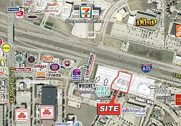
Closeup Aerial
Las Colinas Aerial
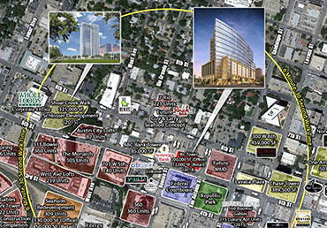
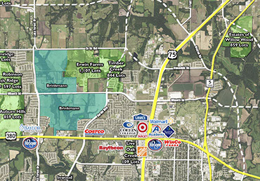
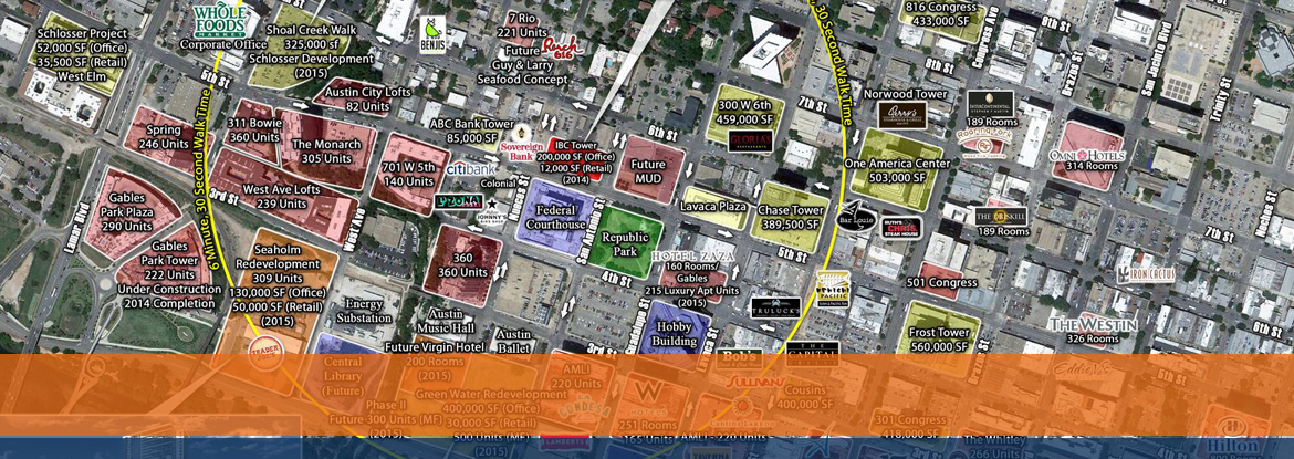
Downtown Austin Aerial
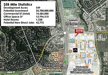
Collin Denton North Aerial
.jpg?crc=17325651)
Learn how we can help.
972.499.8100
Get a Free Estimate.
No obligation.
Have Questions?
Email Us.
Expert Solutions
Know What It Costs
Get In Touch
YOUR VISION. OUR EXPERTISE. BETTER RESULTS.
Let's Get Started On Your Custom Solution Today.
Our goal is to build and expand a simplified “pay-as-you-go” service model that exceeds what a traditional, in-house operation can provide and eliminates the overhead. Enabling our team members to react and respond to our clients’ specific needs, Earthvision has successfully built a disruptive business model that delivers a better product, with a higher level of service, than what is common within a traditional real estate firm.
USEFUL LINKS
About Us
Retail Analysis
Customer Analytics
Aerial Graphics
Property Marketing
Case Studies
Contact Us
CONTACT INFO
1702 North Collins Blvd, Suite 211
Richardson, Texas 75080